Geek
Chief Minister (5k+ posts)
Before I say anything, lets view following pictures, available publicly on Google Maps:


To view more images, and detailed geographical information of the Navy Base, PNS Mehran, that is being attacked by around or over a dozen highly armed gunmen, click here
You will witness that Google has updated satellite imagery of entire base, assets, compounds, buildings, its surroundings, fields and Chakora Nala around the base walls.
By going through the entire base via Google Maps, and navigating through the images available in there, one may not deny the fact that this service might have served terrorists for laying out their attack plan.
Due level of details mentioned in maps, it is likely that terrorists had studied these (Google) maps so well before their attack.
Like other nations, including India, at this point of time Pakistan government should direct Google to stop taking satellite images of sensitive locations through out the country. Government of Pakistan, through Ministry of IT, should send a detailed list of deployments where Google should be asked to blur the images and/or not take close-up images.
Now I am not saying that banning Google Maps for these sensitive locations will altogether stop terrorist attacks, but it will play a role in securing our installations, to some extent at least.
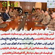
Attack Details:
The militants stormed hangars housing aircraft, officials said. Destroying at least one Maritime surveillance aircraft, P3C-Orion.
According to BBC theres a possible hostage situation at PNS Mehran
As of now, 4 deaths, half a dozen injuries are confirmed by DG PR Pakistan Navy
Officials say it is a terror attack, and commandos are fighting back.
No group has claimed the raid
The operation is continuing
http://propakistani.pk/2011/05/23/pns-mehran-govt-should-ban-google-maps-for-sensitive-locations/
To view more images, and detailed geographical information of the Navy Base, PNS Mehran, that is being attacked by around or over a dozen highly armed gunmen, click here
You will witness that Google has updated satellite imagery of entire base, assets, compounds, buildings, its surroundings, fields and Chakora Nala around the base walls.
By going through the entire base via Google Maps, and navigating through the images available in there, one may not deny the fact that this service might have served terrorists for laying out their attack plan.
Due level of details mentioned in maps, it is likely that terrorists had studied these (Google) maps so well before their attack.
Like other nations, including India, at this point of time Pakistan government should direct Google to stop taking satellite images of sensitive locations through out the country. Government of Pakistan, through Ministry of IT, should send a detailed list of deployments where Google should be asked to blur the images and/or not take close-up images.
Now I am not saying that banning Google Maps for these sensitive locations will altogether stop terrorist attacks, but it will play a role in securing our installations, to some extent at least.
Attack Details:
The militants stormed hangars housing aircraft, officials said. Destroying at least one Maritime surveillance aircraft, P3C-Orion.
According to BBC theres a possible hostage situation at PNS Mehran
As of now, 4 deaths, half a dozen injuries are confirmed by DG PR Pakistan Navy
Officials say it is a terror attack, and commandos are fighting back.
No group has claimed the raid
The operation is continuing
http://propakistani.pk/2011/05/23/pns-mehran-govt-should-ban-google-maps-for-sensitive-locations/