
- Joined
- Feb 1, 2014
- Posts
- 32,099
- Reaction score
- 16,723
- Points
- 113
Surgical Strike in Pakistan a Botched Operation?
Indian jets carried out a strike against JEM targets inside Pakistani territory, to questionable effect
Indian fighter jets carried out strikes against targets inside undisputed Pakistani territory, but open-source evidence suggested that the strike was unsuccessful.
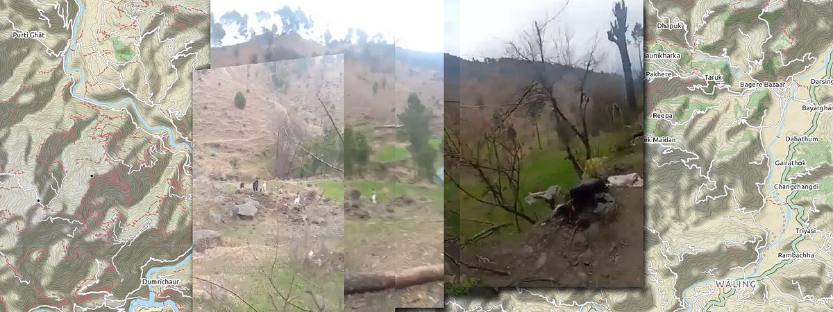
At around 3:30 a.m. local time on February 26, a flight of 12 Mirage 2000 multi-role fighters reportedly attacked facilities of the terrorist group Jaish-e-Mohammad (JEM) near Balakot town in Mansehra District, Pakistan. Using open-source evidence, @DFRLab was able to geolocate the site of the attack and provide a preliminary damage assessment.
While most sources at the time identified the strike as taking place in the Pakistani town of Balakot, others located the strike at “Jaba Top,” a likely reference to a mountain top near the village of Jaba, about 10 kilometers south of Balakot.
Identification
On the morning of the February 26, after daybreak, a spokesperson for the Pakistan Armed Forces, Major General Asif Ghafoor, tweeted images from what he alleged to be the impact area of the Indian bombs.
Ghafoor claimed that the payload was dropped in a hurry and impacted in an open area. The immediate imagery seemed to corroborate the statement, as the photographs were taken in a wooded area and did not show any damaged structures.
Two photos included fragments from the ordinance supposedly dropped by the Indian fighter jets. One image contained what looked like a set of tail fins and another what appeared to be a component for the targeting system.
The most identifiable photo was of the fins, which closely resembled those on the Israeli-produced SPICE-2000 precision-guided munitions (PGM). SPICE uses INS/GPS coordinates for autonomous navigation and electro-optical seekers for target identification and terminal navigation. According to Rafael, the manufacturer of the SPICE series of PGMs, the electro-optical sensor matches the scene with pre-loaded imagery for accurate target acquisition and homing.
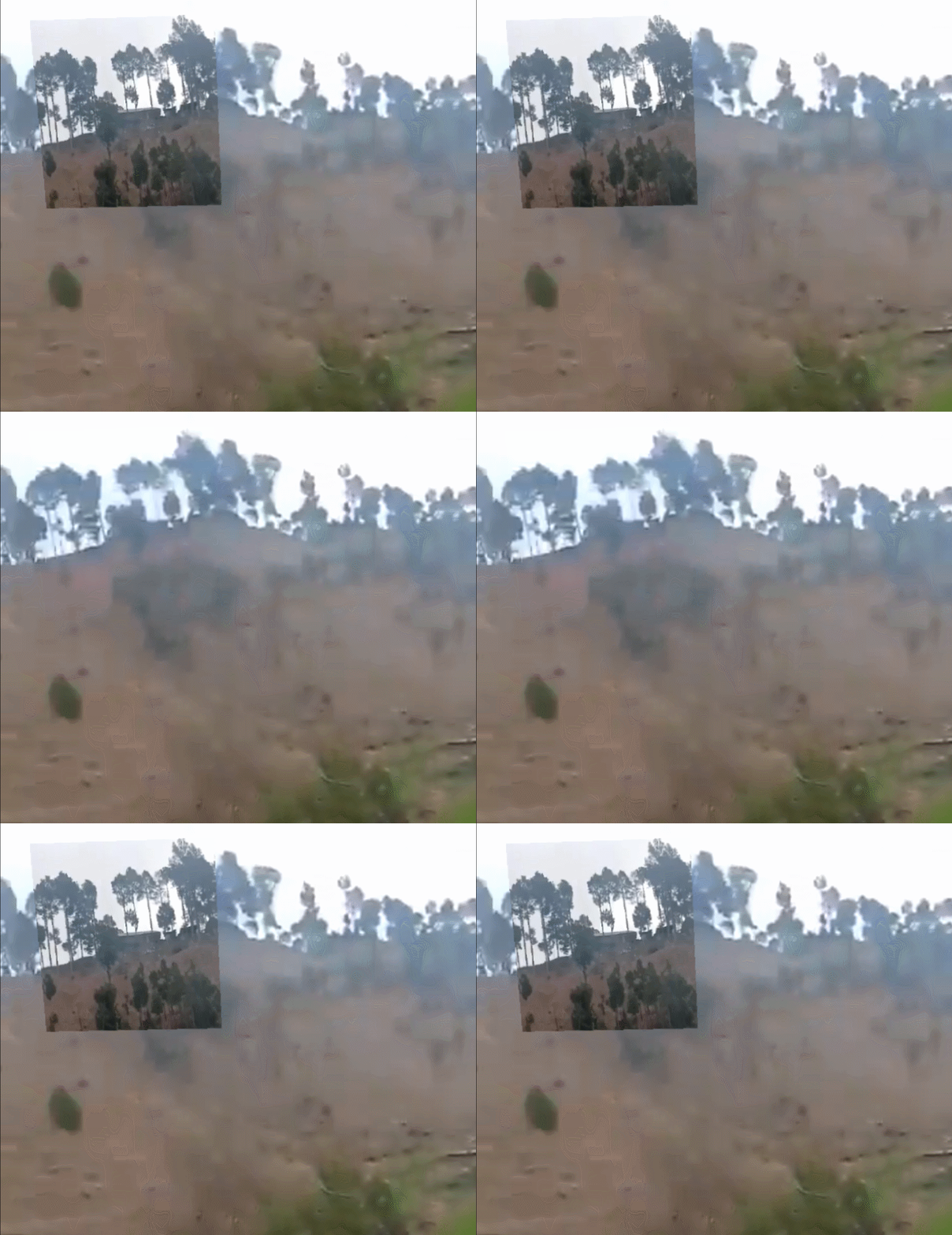
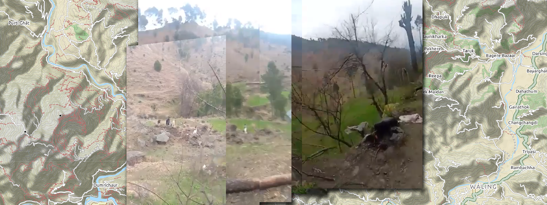
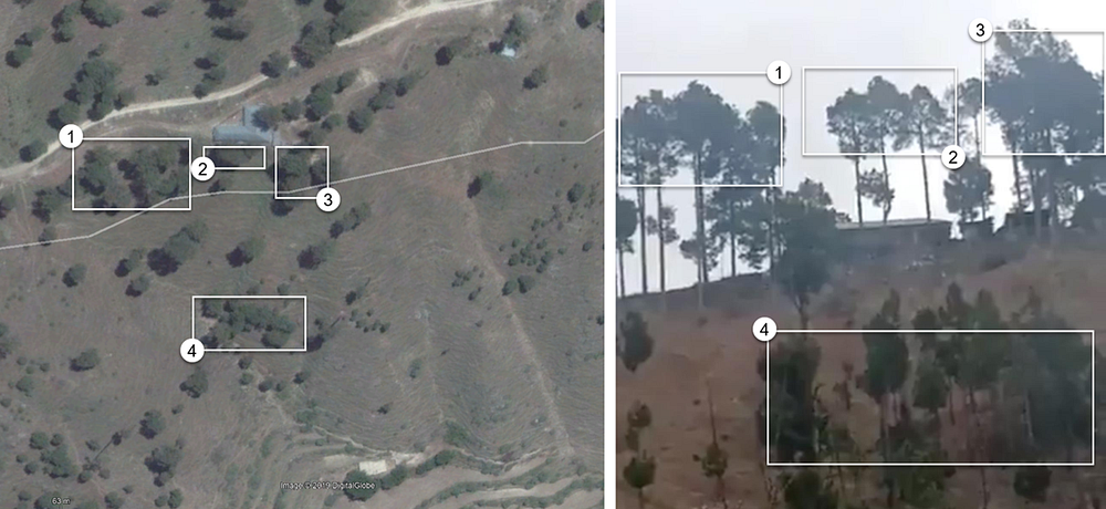
Using this more detailed imagery, @DFRLab was able to confirm conclusively that this strike did in fact take place near Jaba Top. A comparison between tree clusters and the buildings visible in the imagery provided a positive match.
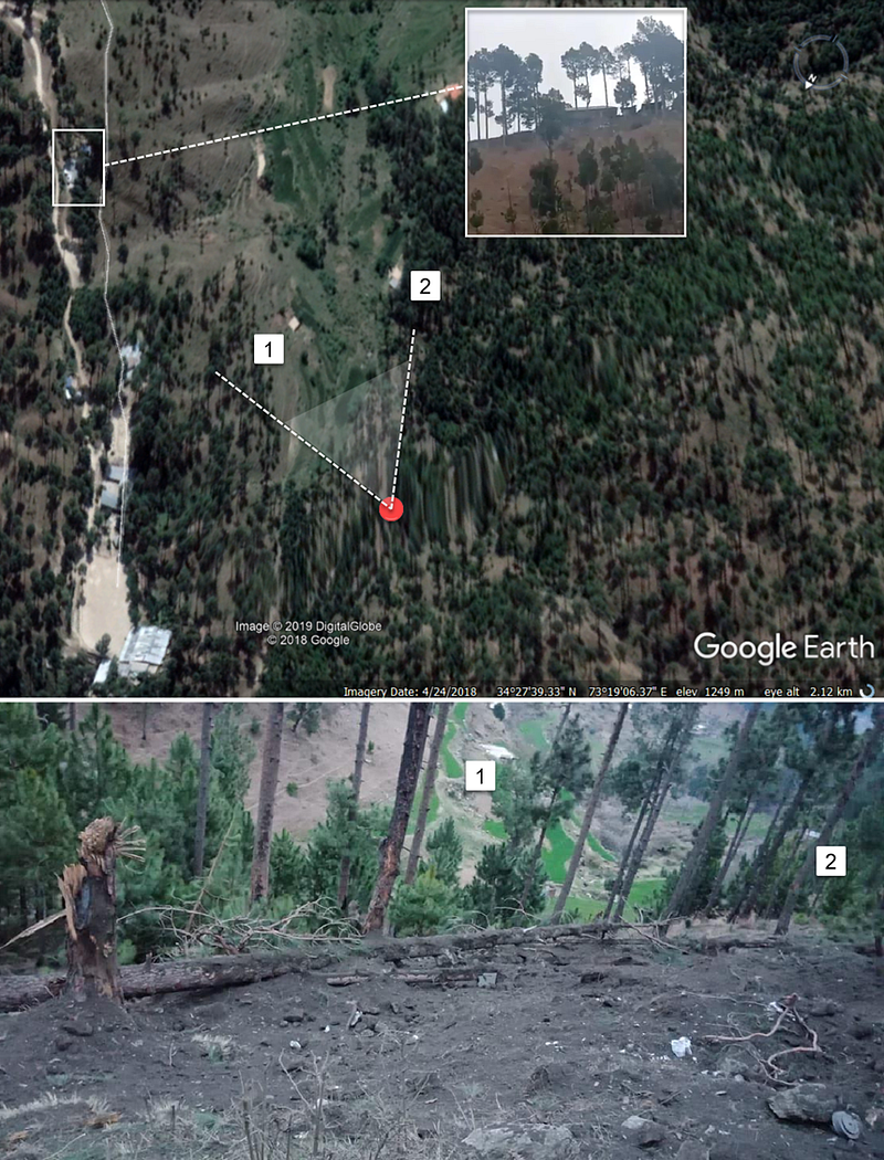
Retired Indian Colonel Vinayak Bhat seemed to agree with this assessment in an article written in the immediate aftermath of the attack, showing satellite imagery of the same location.
Additional footage of the targeted facility was released on Twitter. In one tweet, Asian News International (ANI) posted an image of what appeared to be a gate and guard post to the entrance of the facility. As Bhat also pointed out, this structure bore a high resemblance to a point along the road leading to the facility on satellite imagery.
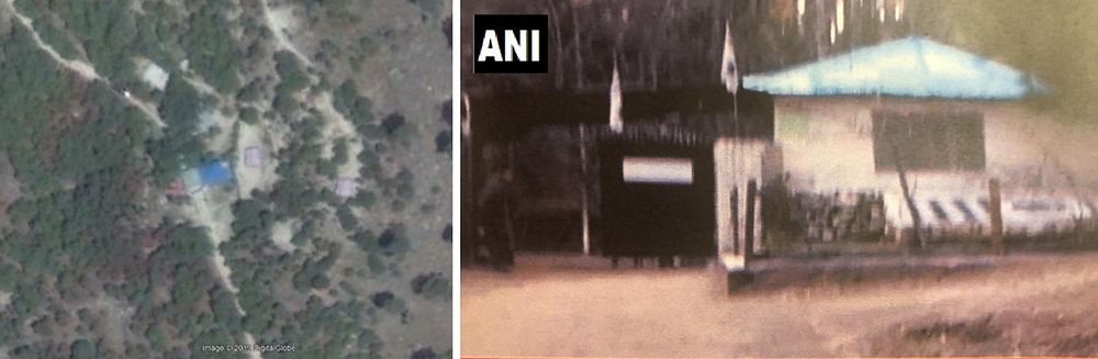
The blue roof combined with the half roof covering the road and the sideroad on the right all contributed to a high-confidence conclusion that these structures were the same.
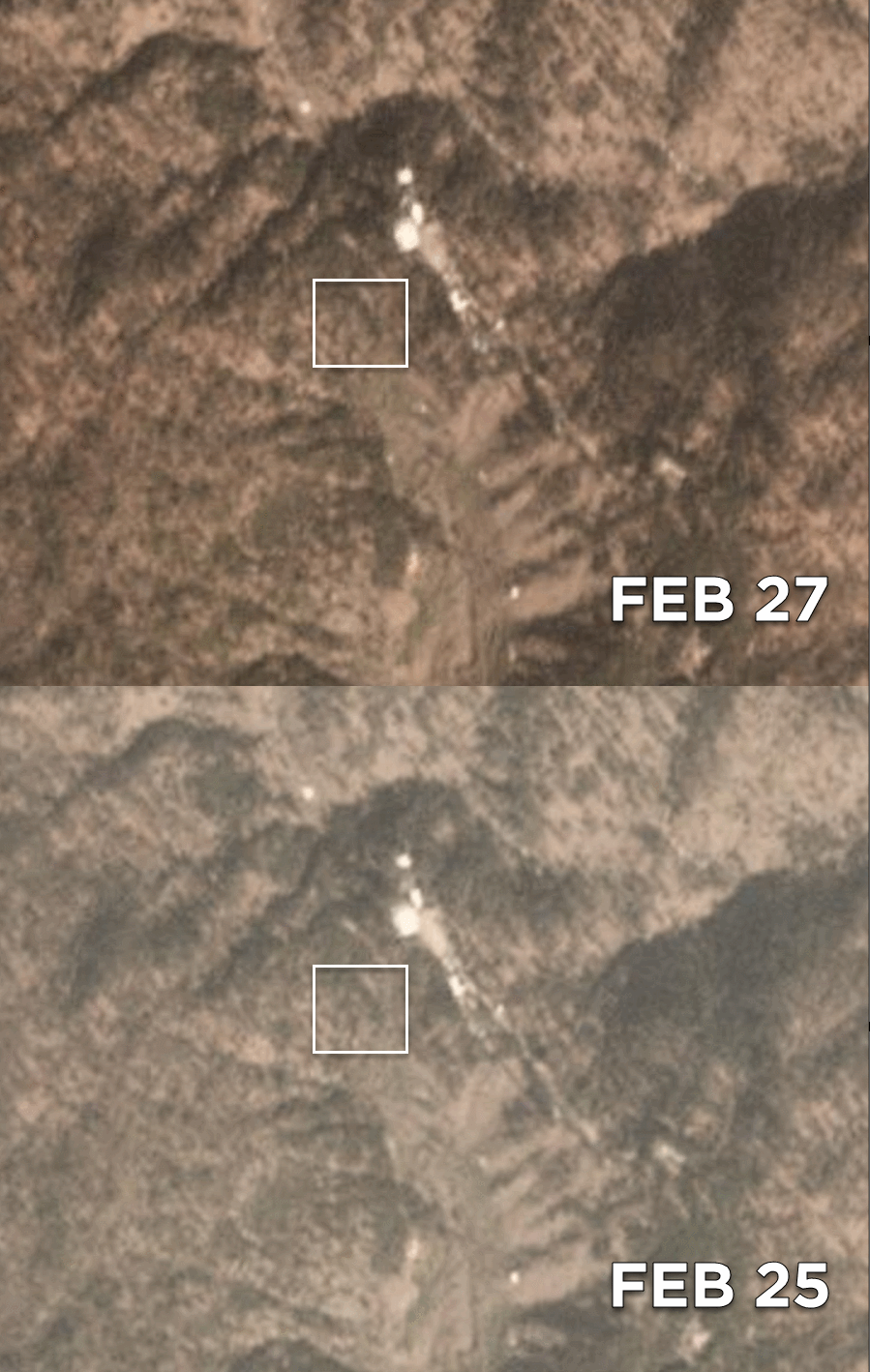
Satellite imagery of the target area before and after the attack. (Source: @DFRLab via Planet Labs)
The change visible in the imagery indicated only impacts in the wooded area, with no damage being visible to the surrounding structures.
Conclusion
Using open-source evidence and satellite imagery, @DFRLab was able to confirm the location of the Indian airstrike to be near Balakot, rather than inside it, and firmly within Pakistani territory. The target was supposedly a JEM-led madrassa, but @DFRLab was unable to confirm that any bombs reached buildings associated with it.
The SPICE-2000 is a precision-guided bomb that should not miss its target by the approximately 100 meters that the impact craters were from the nearest structures. The autonomous nature of the SPICE-2000 adds mystery to why the bombs seemed to miss. Satellite imagery did not suggest that any damage was inflicted to nearby buildings. Vegetation and low imagery resolution could hypothetically obscure structural damage, but this remains highly improbably. Something appears to have gone wrong in the targeting process — exactly what, however, remains unclear in the open-source evidence.
@DFRLab will continue to monitor this situation as it develops.
Michael Sheldon is an Digital Forensic Research Associate at the Atlantic Council’s Digital Forensic Research Lab ([I]@DFRLab[/I]).
Surgical Strike in Pakistan a Botched Operation?
Indian jets carried out a strike against JEM targets inside Pakistani territory, to questionable effect
- Featured Thumbs
- https://i.imgur.com/3KpVb1f.jpg
Last edited by a moderator:


